How We Explored the Depths of the Earth in Latvia?

Deep drilling research, which allows us to uncover the hidden secrets of the Earth’s crust, is one of the most exciting and cutting-edge fields of Earth sciences.

During deep drilling research, we use specialized instruments to examine the walls of the boreholes, properties of rocks, movement of fluids with geophysical methods. This information helps us gain a better understanding of the Earth’s internal structure, geothermal energy potential, water resources, and environmental changes.

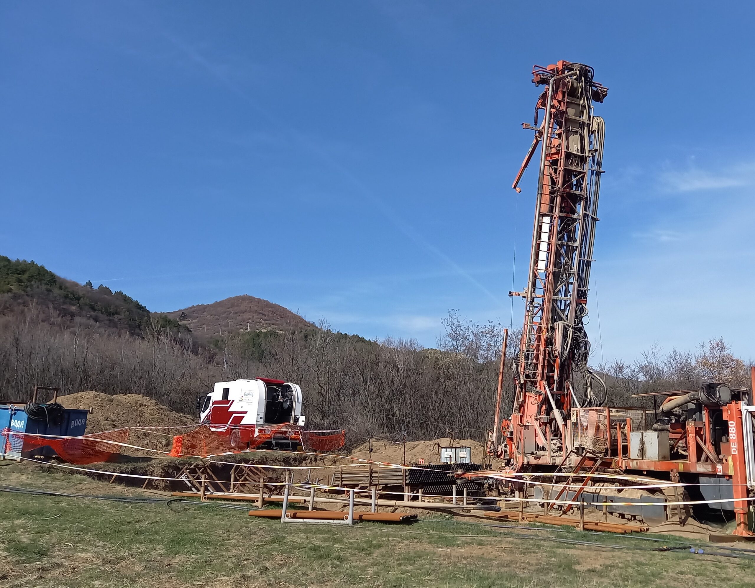
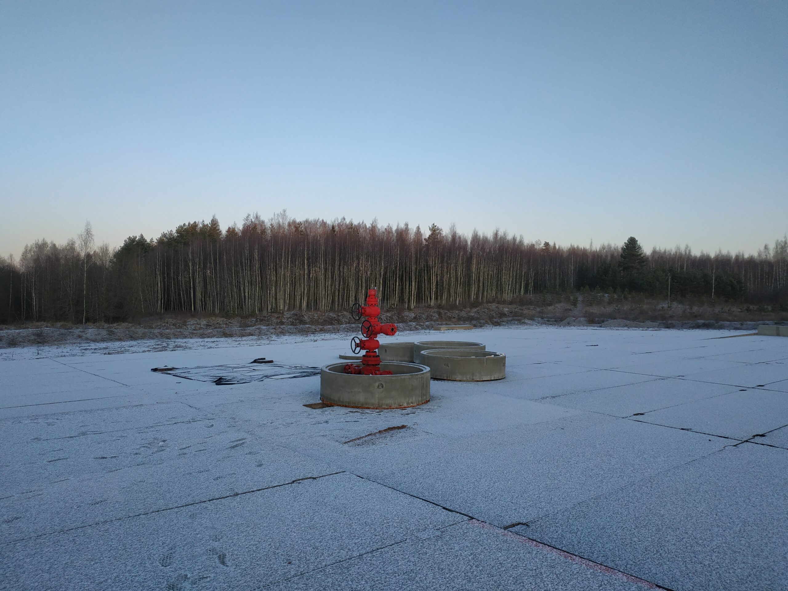
In Latvia, we conducted comprehensive borehole measurements in almost 900 meters deep wells in June 2019. This marked the first time we applied nuclear magnetic resonance (NMR) tests in such large-diameter drilling for industrial research purposes. In addition to NMR tests, we also performed spectral-gamma, natural gamma, caliper, and temperature measurements. 

  • NMR tests are methods that allow us to determine the porosity, water content, and permeability of rocks. These properties are essential to estimate the amount of geothermal energy that can be extracted from a particular area.

  • Spectral-gamma and natural gamma measurements are methods that help determine the mineral composition and lithology of rocks. These properties are vital to identify the types of rocks present and understand their formation.

  • Caliper measurement is a method that allows us to determine the diameter and shape of the borehole. This property is crucial to assess the drilling quality and understand how the geometry of the borehole influences other measurement results.

In early January 2020, we conducted vertical seismic profiling (VSP) measurements in the same borehole in collaboration with a Lithuanian company, Geobaltic. The seismic vibrators were provided by our Lithuanian partner, and our task was data collection and analysis. VSP measurements are methods that allow us to determine the seismic velocity and impedance of rocks. These properties are crucial to identify the seismic waves propagating in the Earth and how they reflect from rock boundaries. The advantage of VSP measurements is their high resolution and accuracy in determining the seismic properties of rocks.

The re-interpretation of the region’s 2D seismic profiles was based on the borehole and VSP measurements. This information helps us gain a better understanding of the geological structure, tectonic movements, and geothermal potential.

In conclusion, deep drilling research is a highly useful and fascinating method that provides valuable insights into the Earth’s depths. Our company is proud to have been part of this project and looks forward to many more opportunities in the future. 


If you would like to learn more about deep drilling research, please visit our website or send us an email.

How We Examined the Mineral and Industrial Water Wells in Transylvania?

We conducted examinations of eight mineral and industrial water wells located in the Transylvania region in May and October 2022. Since the wells were in continuous use, we had to carry out the examination in two phases, one well in May and seven wells in October.

During the investigations, we performed camera surveys, identified well structures, and determined the productive layers. At some wells, we also conducted surface water and gas sampling, deep water sampling, gas-water ratio determination, and laboratory tests.

In our expert report, we not only analyzed the results of some of these examinations but also included laboratory findings and camera footage, along with recommendations for the improvement of some wells.

The examination of the mineral and industrial water wells in Transylvania yielded several interesting and significant findings.

The camera surveys allowed us to determine the condition of the wells’ structure, the materials they were made of, their depth, and the issues they faced.

For instance, some wells had damaged or clogged pipelines, while others had malfunctioning pumps.

During the detection of productive layers, we identified from which layers are still productive and the amount each of them produced.

In some wells, a significant amount of gas was released with the water, indicating their potential for gas production as well.

During surface water and gas sampling, we measured parameters such as water temperature, pH, electrical conductivity, oxygen content, and carbon dioxide content. We also determined the composition of the gas, which was primarily methane.

Deep water sampling involved using specialized tools to collect samples from the productive layers, which were then sent to the laboratory for further analysis. Laboratory tests helped us ascertain the water’s mineral content, hardness, organic matter content, and microbiological quality. Some of the examined waters showed high mineral content, suggesting potential therapeutic properties.

Based on the examination results, we prepared an expert report containing recommendations for the repair, maintenance, and development of the wells.

  • For some wells, we suggested replacing or cleaning the pipelines, while for others, repairing or replacing the pumps was advised.
  • In wells suitable for gas production, we recommended optimizing the gas-water ratio and finding solutions for gas extraction and storage.
  • In the case of therapeutic waters, we proposed continuous water quality monitoring and exploration of water utilization possibilities.

The examination of the mineral and industrial water wells in Transylvania provided numerous interesting and useful insights into the wells’ condition, structure, productive layers, and water and gas quality.

Based on the examination results, we prepared an expert report with recommendations for the improvement, maintenance, and development of the wells.


We hope that these investigations will contribute to the more efficient and sustainable utilization of the mineral and industrial water wells in Transylvania.

Rock mechanic surveys in Bulgaria: A thrilling adventure in the underground world

One of the most exciting projects of 2023 for us was when an international mining company commissioned us to conduct surveys in an ore mine located 80 km west of Sofia.

During the survey, we examined the rocks using acoustic probes and conducted measurements for borehole orientation, natural gamma radiation, caliper, and temperature. By determining the geological formation layers and assessing the rock formation’s fracturing, we provided valuable information for planning future mining operations in these inclined formations.

After evaluating the logs and determining the fractured areas, we established the width, depth, orientation, and direction of the fractures, as well as the potential fluid flow between the fractured zones.

Throughout the project, we not only provided useful data to the mining company but also learned a lot about Bulgarian rocks and ore mining.

One of the most memorable moments of the project was when we visited the mine and witnessed the ore being extracted based on our surveys. The bright and colorful ore pieces were a magnificent sight and revealed the rich resources hidden beneath the Earth’s surface. The miners expressed their gratitude for our work, which made their job easier and safer.

We are delighted to have been part of this project and contributed to the advancement of Bulgarian mining. 

We hope to undertake many similar surveys in the future!