Geotechnical examination of the Chain bridge’s pillars with geophysical methods

In 2021, at the beginning of the Chain bridge’s restoration, our company has been commissioned to examine the static state of the bridge’s pillars on both the Buda and the Pest side. 

During these tests we have examined the pillars’ and icebreakers’ condition and the possible gaps in them, and also the physical parameters, solidity, porosity and permeability of the blocks of stone filling the pillars. 

The most important part of our task was to provide data based on which the inoculation procedures could be planned (how the pillars should be inoculated and locating the possible cavities…).

We have suggested two separate methods to survey the pillars’ condition:

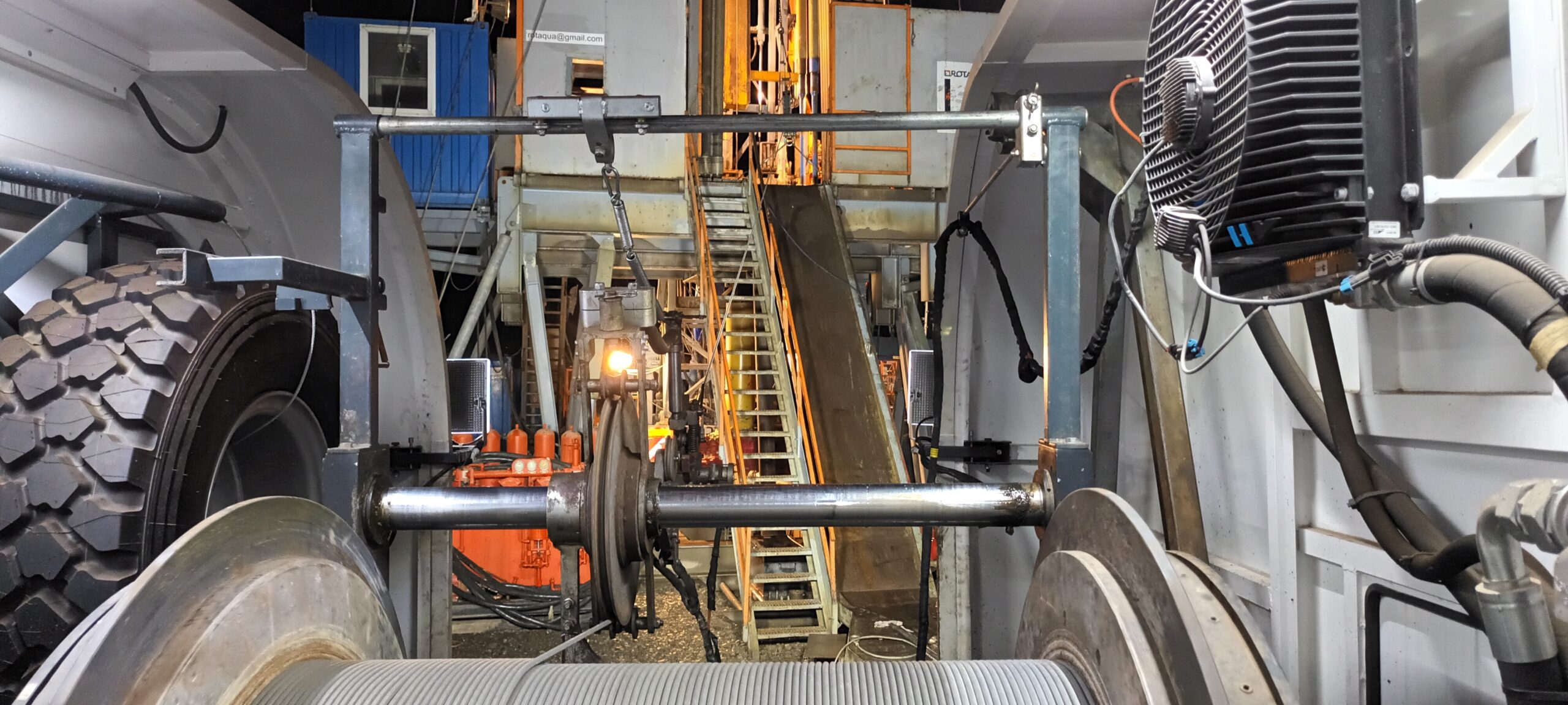
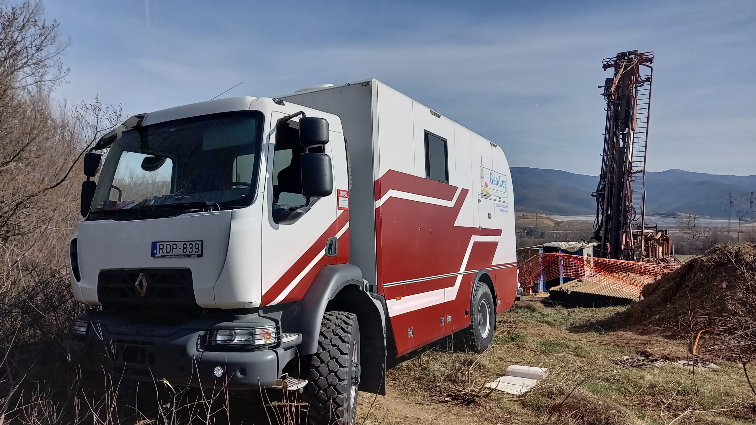
  • Borehole geophysical measurements, camera recordings and laboratory testing in wells drilled in certain points in the pillars (1 well in each pillar) and the icebreakers (two drillings in the Northern icebreaker on the Pest side)
  • 3D seismic screenings of the pillars’ structure above the water

The inoculation program has been planned based on the results of the core sample and geophysical examinations. 

Our repeated 3D seismic screenings in 2022 have proven the inoculation process’s success.

How We Explored the Depths of the Earth in Latvia?

Deep drilling research, which allows us to uncover the hidden secrets of the Earth’s crust, is one of the most exciting and cutting-edge fields of Earth sciences.

During deep drilling research, we use specialized instruments to examine the walls of the boreholes, properties of rocks, movement of fluids with geophysical methods. This information helps us gain a better understanding of the Earth’s internal structure, geothermal energy potential, water resources, and environmental changes.

In Latvia, we conducted comprehensive borehole measurements in almost 900 meters deep wells in June 2019. This marked the first time we applied nuclear magnetic resonance (NMR) tests in such large-diameter drilling for industrial research purposes. In addition to NMR tests, we also performed spectral-gamma, natural gamma, caliper, and temperature measurements. 

  • NMR tests are methods that allow us to determine the porosity, water content, and permeability of rocks. These properties are essential to estimate the amount of geothermal energy that can be extracted from a particular area.

  • Spectral-gamma and natural gamma measurements are methods that help determine the mineral composition and lithology of rocks. These properties are vital to identify the types of rocks present and understand their formation.

  • Caliper measurement is a method that allows us to determine the diameter and shape of the borehole. This property is crucial to assess the drilling quality and understand how the geometry of the borehole influences other measurement results.

In early January 2020, we conducted vertical seismic profiling (VSP) measurements in the same borehole in collaboration with a Lithuanian company, Geobaltic. The seismic vibrators were provided by our Lithuanian partner, and our task was data collection and analysis. VSP measurements are methods that allow us to determine the seismic velocity and impedance of rocks. These properties are crucial to identify the seismic waves propagating in the Earth and how they reflect from rock boundaries. The advantage of VSP measurements is their high resolution and accuracy in determining the seismic properties of rocks.

The re-interpretation of the region’s 2D seismic profiles was based on the borehole and VSP measurements. This information helps us gain a better understanding of the geological structure, tectonic movements, and geothermal potential.

In conclusion, deep drilling research is a highly useful and fascinating method that provides valuable insights into the Earth’s depths. Our company is proud to have been part of this project and looks forward to many more opportunities in the future. 


If you would like to learn more about deep drilling research, please visit our website or send us an email.

How We Examined the Mineral and Industrial Water Wells in Transylvania?

We conducted examinations of eight mineral and industrial water wells located in the Transylvania region in May and October 2022. Since the wells were in continuous use, we had to carry out the examination in two phases, one well in May and seven wells in October.

During the investigations, we performed camera surveys, identified well structures, and determined the productive layers. At some wells, we also conducted surface water and gas sampling, deep water sampling, gas-water ratio determination, and laboratory tests.

In our expert report, we not only analyzed the results of some of these examinations but also included laboratory findings and camera footage, along with recommendations for the improvement of some wells.

The examination of the mineral and industrial water wells in Transylvania yielded several interesting and significant findings.

The camera surveys allowed us to determine the condition of the wells’ structure, the materials they were made of, their depth, and the issues they faced.

For instance, some wells had damaged or clogged pipelines, while others had malfunctioning pumps.

During the detection of productive layers, we identified from which layers are still productive and the amount each of them produced.

In some wells, a significant amount of gas was released with the water, indicating their potential for gas production as well.

During surface water and gas sampling, we measured parameters such as water temperature, pH, electrical conductivity, oxygen content, and carbon dioxide content. We also determined the composition of the gas, which was primarily methane.

Deep water sampling involved using specialized tools to collect samples from the productive layers, which were then sent to the laboratory for further analysis. Laboratory tests helped us ascertain the water’s mineral content, hardness, organic matter content, and microbiological quality. Some of the examined waters showed high mineral content, suggesting potential therapeutic properties.

Based on the examination results, we prepared an expert report containing recommendations for the repair, maintenance, and development of the wells.

  • For some wells, we suggested replacing or cleaning the pipelines, while for others, repairing or replacing the pumps was advised.
  • In wells suitable for gas production, we recommended optimizing the gas-water ratio and finding solutions for gas extraction and storage.
  • In the case of therapeutic waters, we proposed continuous water quality monitoring and exploration of water utilization possibilities.

The examination of the mineral and industrial water wells in Transylvania provided numerous interesting and useful insights into the wells’ condition, structure, productive layers, and water and gas quality.

Based on the examination results, we prepared an expert report with recommendations for the improvement, maintenance, and development of the wells.


We hope that these investigations will contribute to the more efficient and sustainable utilization of the mineral and industrial water wells in Transylvania.

Rock mechanic surveys in Bulgaria: A thrilling adventure in the underground world

One of the most exciting projects of 2023 for us was when an international mining company commissioned us to conduct surveys in an ore mine located 80 km west of Sofia.

During the survey, we examined the rocks using acoustic probes and conducted measurements for borehole orientation, natural gamma radiation, caliper, and temperature. By determining the geological formation layers and assessing the rock formation’s fracturing, we provided valuable information for planning future mining operations in these inclined formations.

After evaluating the logs and determining the fractured areas, we established the width, depth, orientation, and direction of the fractures, as well as the potential fluid flow between the fractured zones.

Throughout the project, we not only provided useful data to the mining company but also learned a lot about Bulgarian rocks and ore mining.

One of the most memorable moments of the project was when we visited the mine and witnessed the ore being extracted based on our surveys. The bright and colorful ore pieces were a magnificent sight and revealed the rich resources hidden beneath the Earth’s surface. The miners expressed their gratitude for our work, which made their job easier and safer.

We are delighted to have been part of this project and contributed to the advancement of Bulgarian mining. 

We hope to undertake many similar surveys in the future!

The 2020-21 Cycle of the BAF Project – Embracing Long-Term Challenges

One of the most defining long-term projects in our company history was the exploration of the Boda Aleurolite Formation (BAF).

The latest field surveys spanned more than a year between October 2020 and the fall of 2021. As before, during the previous exploration cycles, once again our company performed all of the logging surveys in the three core drillings in development back then.

These included complex geophysical well-logging, acoustic BHTV surveys, flowmeter surveys, VSP, NMR surveys and downhole water sampling.

For the first time during the entirety of the project we managed to perform pre-planned NMR surveys for research purposes instead of testing or trial. The thoroughness of this research project is also indicated by the fact that our company was tasked to perform almost all geophysical well-logging services we possibly could at the time.

During the project, we not only collected a lot of valuable data about the BAF, but also improved ourselves in the application of geophysical methods.

The BHTV surveys gave us a detailed picture of the rock fracturing and structure, which provided important information about the hydrogeological conditions.

The VSP surveys refined the seismic data and determined the velocity and elasticity of the rocks.

The NMR surveys opened up new possibilities for determining the porosity and water content of the rocks.

One of the biggest challenges of the project was that the core drillings were done at great depths and in oblique directions, which made it difficult to lower and pull up the instruments. In addition, the environmental conditions were variable, so we had to adapt to the weather and terrain.

During the project, we faced several technical difficulties, such as instrument failures or data loss, but we managed to solve them all successfully.

At the end of the project, we proudly handed over our report to the client, who were very satisfied with the results. The exploration of the BAF contributed to a better understanding of Hungary’s geological background and mineral resources.

We hope to participate in many more similar projects in the future!

Revisiting Karst Water Level Monitoring Wells in the Transdanubian Central Range

During the project, 217 wells of the karst water level monitoring network in the Transdanubian Central Mountains were examined from the point of view of well structure and well hydraulics.

At the regional level, the main problem in the years following the overexploitation period (1960-1989) is the regeneration of the karst system, which causes an increase in the karst water level.

The main goal is to establish that the wells are still well suited for water level measurements and that the data measured by the water directorates can be relied upon reliably and conclusions can be drawn. The task is to find out the exact location of the wells, assess their condition, measure the well structure with a trolley (natural-gamma, temperature, hole width, continuous temperature profiling, ring space inspection, possibly color video camera recording) and well hydraulics (well capacity and backfilling, continuous temperature during production , differential temperature profiling, flow / swallow flow measurement,) conditions.

During the project, unforeseen problems arose with the accessibility and measurement of the wells, which made the work even more interesting and exciting.

Nearly 85% of the wells set in the project were measured, and due to their condition, only 70% of their depth could be measured. In terms of depth, the smallest was 9.5m and the deepest was about 970m.

In the case of most wells, there were obstacles that affected the course of the measurement and could presumably also affect the measurement of the degree of water level change.


Among the observed wells, we found ones that were especially suitable and unsuitable in terms of their operation and water level measurability.

Interaction tests of geothermal wells in Tótkomlós

At the beginning of 2023, an important milestone of a project that started in 2019 was reached. We had to determine the interaction of two production and two injection geothermal wells in the Tótkomlós area by performing production and injection tests. Our company participated in this work together with several other companies, and our task was to continuously register surface and depth parameters at exceptionally high temperatures of 130-140 °C for Hungarian geothermal conditions.

We registered the depth pressure and temperature simultaneously in all four wells, using high-temperature memory probes installed by slickline method.

In addition, we had to continuously register online the wellhead pressure, the amount and temperature of the outflowing water, determine the gas-water ratio, take gas-water samples and perform laboratory tests on the well that was operating at the time.

At the end of the tests, we provided our partners with a total of 290 hours of depth and 140 hours of surface registered data.

Geothermal wells are boreholes that reach deep into the Earth’s crust and tap into the hot water or steam that can be used for various purposes, such as heating, cooling or electricity generation.

Geothermal wells can be classified into two main types: production wells and injection wells. Production wells are those that bring the geothermal fluid to the surface, while injection wells are those that return the cooled fluid back to the reservoir.

The interaction of geothermal wells is an important factor that affects the performance and sustainability of a geothermal system. The interaction can be positive or negative, depending on the distance, orientation and operation mode of the wells.

To measure the interaction of geothermal wells, various methods can be used, such as production and injection tests, tracer tests, pressure interference tests and temperature interference tests.

One of our company’s specialization is conducting production and injection tests, as well as registering depth pressure and temperature data with high-temperature memory probes. We use modern equipment and techniques to ensure the accuracy and reliability of our measurements.

We believe that geothermal energy is a valuable resource that can provide clean, renewable and affordable energy for Hungary and beyond.

The adventures of geothermal explorers in Slovakia

Our company participated in several geothermal investigations in Slovakia in 2022. We performed measurements in two phases at a 2500 m deep production well and an 1800 m deep injection well in Csilizradvány.

In the first cycle, we conducted well structure inspection, pressure gradient and flow measurements in both wells. In the second cycle, we carried out depth pressure and temperature registration with wireline technology and memory probes for several months during interaction tests in both wells simultaneously.

The aim of the tests was to determine whether more heat energy could be extracted from the wells for heating local economic facilities.

We also carried out deep drilling geophysical surveys in a geothermal exploration well in Košice, Kežmarok and Liptovský Mikuláš for the entire section up to 2500 m or more.

The surveys included electrical resistance, natural gamma, temperature, hole diameter, acoustic wave image and hole deviation measurements.

This was followed by well tests (well structure and cement bond checks, flow profile determination), hydrodynamic measurements, gas-water ratio determination and sampling in the already completed cased wells.

The aim of the research was to provide cheaper renewable heat energy to the nearby settlements and industrial facilities with thermal water.

Geothermal energy is a promising source of renewable energy that can reduce greenhouse gas emissions and dependence on fossil fuels.

This energy can be used for various purposes, such as electricity generation, heating, cooling, agriculture and recreation. It has many advantages, such as high efficiency, low environmental impact, reliability and availability.

However, geothermal energy also faces some challenges, such as high initial costs, technical difficulties, geological risks and environmental issues.

Our company is committed to developing and implementing innovative solutions for geothermal energy utilization in Slovakia and beyond. We have extensive experience and expertise in geothermal exploration, drilling, testing and monitoring.


We believe that geothermal energy can play a significant role in the transition to a low-carbon economy and society.

Evaluation of Wells for Szeged Waterworks: A Fascinating Undertaking

In 2020, we embarked on an ambitious journey with Szeged Vízmű Zrt., the esteemed waterworks serving the city of Szeged.

Our mission?

To conduct camera inspections, analyze well structures, and determine production profiles for 27 vital stratified water wells supplying the city’s water.

These wells, ranging from 400 to 500 meters deep—remarkably deep in a Hungarian context—offered unique challenges and discoveries. The camera inspections unveiled intriguing details, but with depth came complexity and a time-intensive process.

For each well, we accumulated an average of 3 hours of captivating video footage. Imagine the magnitude!

As the project concluded, our Client received over 10 kilometers of well structure footage, totaling nearly 100 hours.

This awe-inspiring endeavor strengthens Szeged’s water supply, and we’re thrilled to contribute to this essential mission.

Stay tuned for more remarkable updates as we continue to deliver excellence!

First Steps towards the Modernization of Our Vehicle Fleet

We are excited to announce a significant step in the modernization and expansion of our vehicle fleet!

Following the successful completion of our company’s most ambitious projects to date—the geological research for the construction of the Paks atomic power plant in 2017 and the BAF project—we have decided to renew and enhance our ever-amortizing vehicle fleet.

To meet the growing demand for geothermic research, we took a crucial step by acquiring a new high-capacity logging truck. This vehicle enables us to undertake more extensive logging projects efficiently.

Simultaneously, we initiated the installment of a medium capacity vehicle, specifically designed for shallower logging projects and open hole logging in the upper parts of thermal water wells. These additions have further strengthened our capabilities in the field of geothermic research.

Previous slide
Next slide

In the second half of 2019, we successfully completed the assembly of two of our latest vehicles. The 15-ton, four-wheel-drive vehicle, equipped with a winch and a cabin, underwent several test measurements and adjustments to ensure optimal performance. Subsequently, on 17th June 2019, we successfully conducted our first set of measurements near Győr.

In our continued effort to enhance our fleet, we proudly inaugurated another vehicle in November 2019—a four-wheel-drive Volkswagen Crafter. The financing for this installment was secured through a building sector tender, allowing us to further expand our geothermic research capabilities.

These new additions to our fleet mark the beginning of a journey towards a more modern, efficient, and effective vehicle infrastructure. We are committed to staying at the forefront of the industry, and these investments enable us to deliver even greater value to our clients and partners.

Stay tuned for more updates as we continue to innovate and improve our services!